Route experience
Stage 4 with a short and readable profile: walk at a steady pace and expect transitions between village, coast, and connectors.
Camino stage
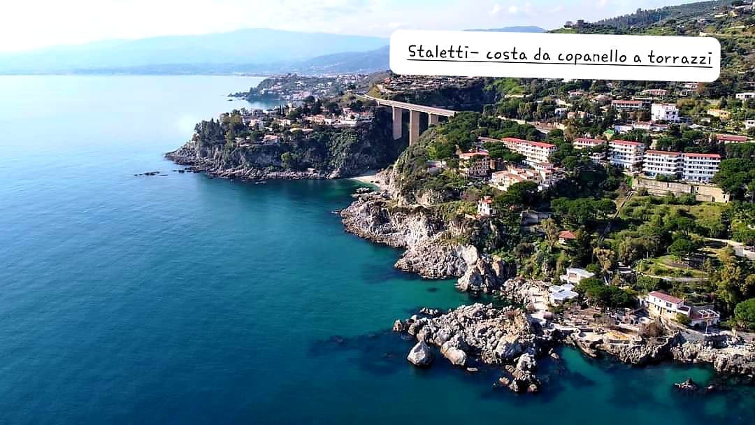
Copanello Lido → pine grove → Motel area
Cross the pine grove and climb toward Motel Gatti, passing the old powder magazine and a high viewpoint over Copanello and the Gulf of Squillace.
A quick visual look at key moments from this stage.
A practical read of this stage: context, on-route experience, and arrival connection.
Copanello Lido → pine grove → Motel area
Route experience
Stage 4 with a short and readable profile: walk at a steady pace and expect transitions between village, coast, and connectors.
Historical/civic value
The ascent touches traces of the historic coastal system (former powder magazine, links toward San Martino).
Naturalistic/archaeological value
Continuous bay and Gulf of Squillace views along a short but scenic segment.
What to notice
Notice the historical and landscape landmarks referenced for this stage, and use the gallery images to recognize key passages.
Services and opportunities
Useful area for scenic pause and connection toward Copanello/Bilbò services.
Main criticalities
Check connector safety between pine grove, road sections, and uphill link toward San Martino/Motel.
GPS and status note
Coordinates are present; follow the route carefully through elevation and connector changes.
Secondary technical summary for this stage.
Practical and safety guidance to walk this stage with confidence.
Save or open this page before you begin. Some areas may have weak signal.
Practical tip: Misto: asfalto, sentiero, scalinata. Difficulty: easy. Duration: Duration pending.
This official route track is provided for orientation. Always follow local signage, current conditions, and local guidance.
Official stage track coming soon.
Open the start point in external maps when coordinates are available.
GPS and status note: Coordinates are present; follow the route carefully through elevation and connector changes.
Coordinates: 38.7536, 16.5695
Useful nearby context: places, issues, and mapped signals.
Nearby issues
Cassiodoro area: sensitive point between crossing, coast access, and uphill connection
Access safety
high
View detailsRebus viewpoint: guardrails, pause space, and readability need improvement
Viewpoint safety
medium
View detailsFons Aretusa: clearer wayfinding is needed between the spring, pine grove, and coast
Wayfinding
low
View detailsNearby places
Cassiodoro Pools
landmark
Copanello Lido
service
Santa Maria Vetere
landmark
Rebus viewpoint
poi
Operational signals linked to this stage.
CDV-CRIT-002 · Tappa 01 — Via Randa
Confermare segnaletica di discesa/risalita verso Copanello Lido e raccordo verso Motel.
Priority: medium
Status: Open
Notes: Rilevata dipendenza tra segmenti consecutivi nel modello repo.
Move to the previous or next stage.
Previous stage
3. Fons Aretusa — Copanello Lido
From the spring to Copanello Lido via the nearby tower, reaching the pine grove and beach for a first sea-level pause.
Next stage
5. Copanello Lido – Cassiodoro Pools and Tomb
From Motel Gatti back to the coast and the Cassiodoro pools, then up toward San Martino/Tomb of Cassiodorus: a short but strategic segment.
Supporting this stage helps improve the public route experience.
Stage sponsor
Available for sponsors, donors, and local partners.
Support / sponsorSupport campaign
Available for sponsors, donors, and local partners.
Support / sponsorMedia available for this stage.


