Status
Published
Project · Public status
Il Cammino del Vento is a STALè civic initiative that makes Stalettì more legible, connected, and cared for: across sea, headland, historical-archaeological heritage, accessibility, and community.
Immagini operative del progetto, riordinabili per slot dalla libreria media.
Single-pass view for municipal decision-makers: purpose, local value, operational status, and resource use.
Status
Published
Urgent issues
4 high priority out of 8 total
Next action
Consolidate high-priority critical nodes, strengthen wayfinding, progressively align operations across connected territorial routes, and begin the recognition path with the Region and any dedicated route registries.
Why it matters
Because this territory is built on connections: between village and coast, historical memory and daily life, natural heritage, marine biodiversity, and new local opportunities. The project has already opened debate, surfaced needs, and brought shared stories and places back into focus.
What Il Cammino del Vento is
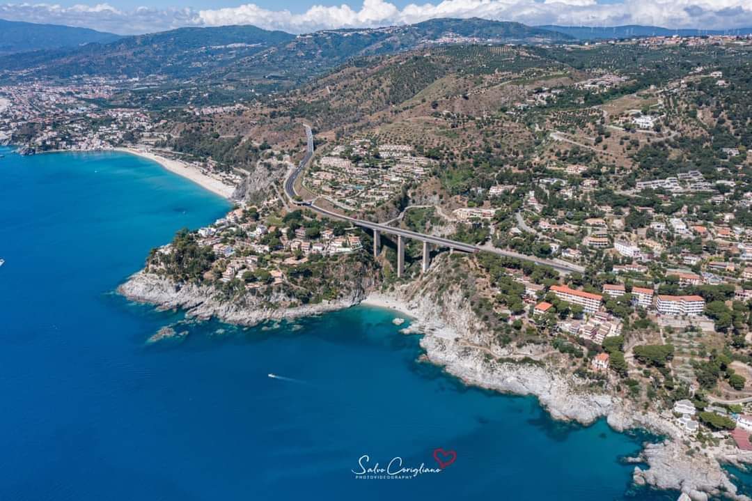
A STALè civic initiative that links sea, countryside, and village into one public experience across Caminia, Copanello, and Stalettì, recovering memory, existing paths, and the spirit of place.
Why it matters to Stalettì
Because this territory is built on connections: between village and coast, historical memory and daily life, natural heritage, marine biodiversity, and new local opportunities. The project has already opened debate, surfaced needs, and brought shared stories and places back into focus.
Project objectives
Make the route legible and safe, coordinate maintenance and wayfinding, and integrate civic monitoring with ongoing public communication.
Current status
The project is in an active public phase: route narrative, issue tracker, updates, and ledger are already online and consultable.
Next milestones
Consolidate high-priority critical nodes, strengthen wayfinding, progressively align operations across connected territorial routes, and begin the recognition path with the Region and any dedicated route registries.
Main criticalities
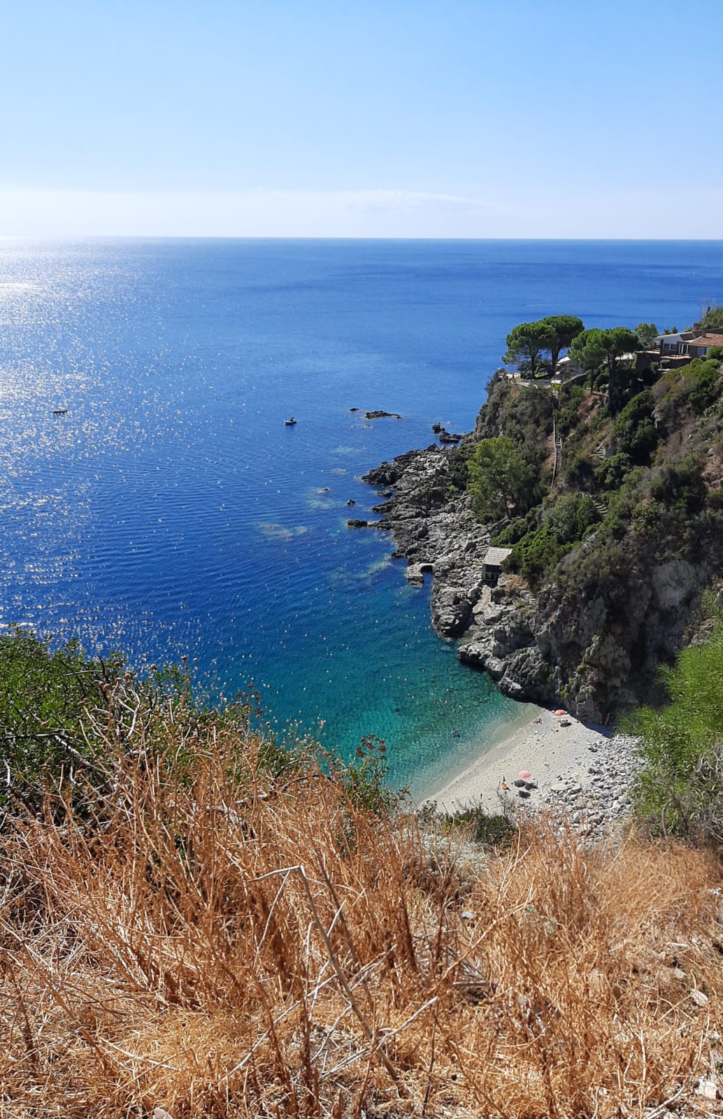
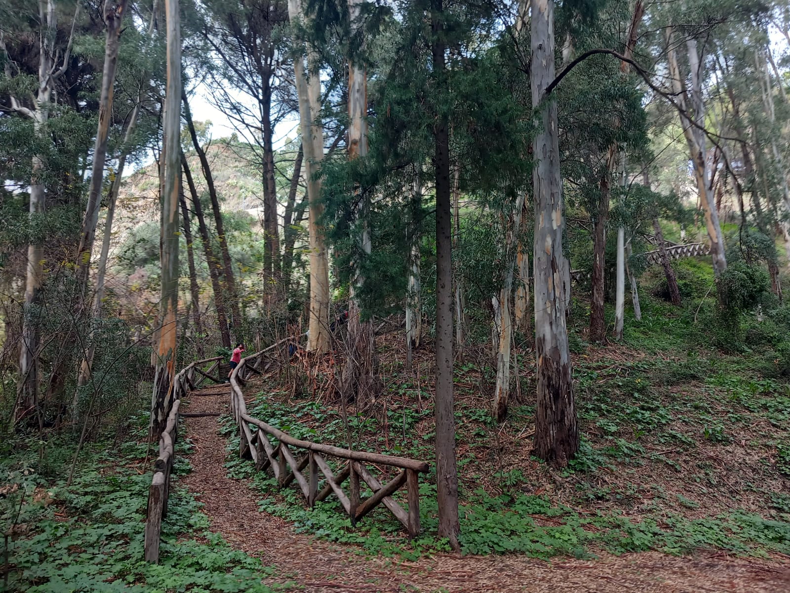
Sensitive access points after rain, crossings requiring safety work, and viewpoints needing continuous maintenance and clearer readability.
Connected territorial ecosystem
The route is part of a broader ecosystem of walking routes, cycle routes, municipalities, GAL, local associations, AIGAE guides, sea-service operators, and the Marine Park Scogliera di Stalettì context. The platform does not claim official roles: it makes connections, needs, updates, and opportunities legible.
How support and resources are used
Resources are allocated to clearing vegetation, cleanup, wayfinding, information panels, safety fences, rest areas, technical site visits, public communication, and operating agreements with local associations.
Public-interest value for municipality and community
The platform helps the project align with slow tourism, accessibility, intelligent signage, QR codes, coast-to-inland connections, and the sustainable enhancement of villages, coastal landscapes, and local heritage.
Current picture
Published
Visible milestones
4 public milestones: system, territory, recognition, maintenance
Territorial ecosystem
Routes, Marine Park, municipalities, GAL, guides, and local services
Tracked resources
€350 entrate · €270 uscite
Latest update
The route grows as a land-sea territorial ecosystem
The project now frames Il Cammino del Vento as a local civic platform connected to routes, municipalities, associations, the Marine Park context, and future slow-tourism services.
Jun 03, 2026
Tracked resources
Monitoring and site visits
Coverage for site visits, rapid surveys, and public updates to the civic tracker.
€90 · Apr 18, 2026
A public view of objectives, milestones, open blockers, and next actions needed to turn the route into real civic infrastructure.
The project starts from Stalettì and takes shape through STALè: a civic and digital space where citizens, institutions, economic operators, and social actors collaborate on a loop route connecting village, coast, countryside, local memory, and future opportunities.
Milestones remain measurable and public: system setup, territorial validation, institutional recognition, and ongoing activation of maintenance and governance.
Next steps already on the table, with public status that can be verified and updated.
Via Randa: drainage and walking surface still need consolidation
Useful access segment into the route system, but still sensitive after rain and in need of a clearer walking surface.
Status: Needs consolidation
Priority: Medium
Fons Aretusa: clearer wayfinding is needed between the spring, pine grove, and coast
The site has high narrative and landscape value, but the route remains hard to read for first-time visitors.
Status: Wayfinding to strengthen
Priority: Low
Cassiodoro area: sensitive point between crossing, coast access, and uphill connection
High-priority node for safety, readability, and visitor flow between heavily used points of interest.
Status: High-priority intervention
Priority: High
Quick access to areas that convert public support and reports into concrete territorial work.