Route experience
Stage 9 with a progressive profile: walk at a steady pace and expect transitions between village, coast, and connectors.

Panoramic climb
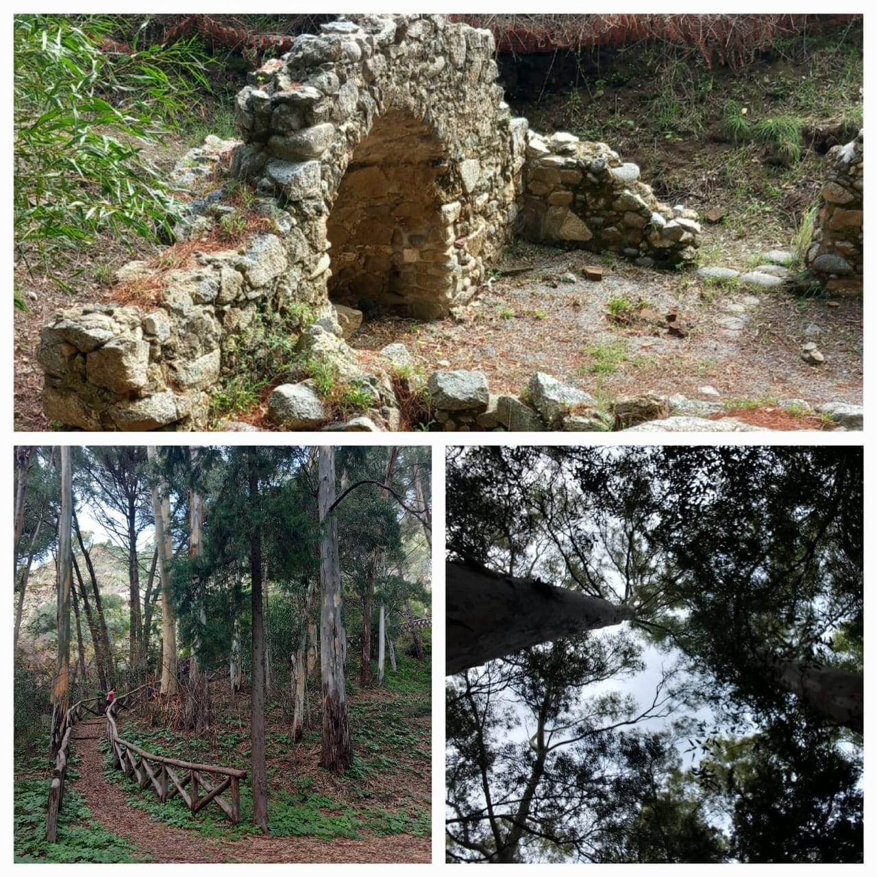
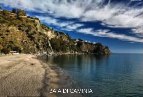
Segment of the Cassiodoro–Caminia system
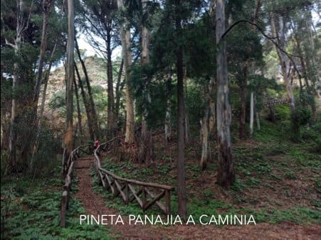
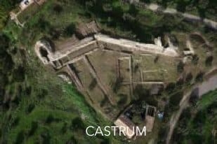
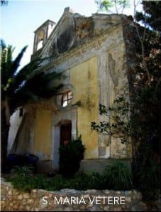
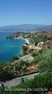
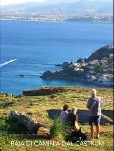
Climb from Caminia through the pine connector to reach Castrum and Santa Maria Vetere, adding a big viewpoint over the south coast.
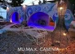
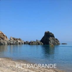
A quick visual look at key moments from this stage.
A practical read of this stage: context, on-route experience, and arrival connection.
Segment of the Cassiodoro–Caminia system
Route experience
Stage 9 with a progressive profile: walk at a steady pace and expect transitions between village, coast, and connectors.
Historical/civic value
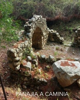
Segment with strong historical and archaeological layering linked to the Cassiodoro/coastal system.
Naturalistic/archaeological value
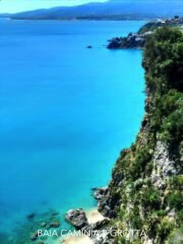
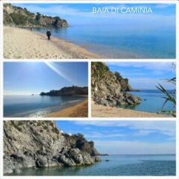
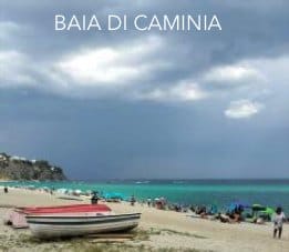
Coastal environment of cliffs, bays, and paths with high landscape value.
What to notice
Notice the historical and landscape landmarks referenced for this stage, and use the gallery images to recognize key passages.
Services and opportunities
Seasonal services between Copanello, Bilbò, and Caminia; verify opening times and access locally.
Main criticalities
Crossings, wayfinding, and connector maintenance still show active criticalities.
GPS and status note
Coordinates are available, but treat the final GPS trace as progressively under verification.
Final GPS trace is pending verification.
Secondary technical summary for this stage.
Practical and safety guidance to walk this stage with confidence.
Save or open this page before you begin. Some areas may have weak signal.
Practical tip: Risalita su sentiero sterrato, poi asfalto ciclo-pedonale. Difficulty: moderate. Duration: 80–100 min.
This official route track is provided for orientation. Always follow local signage, current conditions, and local guidance.
Official stage track coming soon.
Open the start point in external maps when coordinates are available.
GPS and status note: Coordinates are available, but treat the final GPS trace as progressively under verification.
Coordinates: 38.7488, 16.5702
Useful nearby context: places, issues, and mapped signals.
Nearby issues
Cassiodoro area: sensitive point between crossing, coast access, and uphill connection
Access safety
high
View detailsRebus viewpoint: guardrails, pause space, and readability need improvement
Viewpoint safety
medium
View detailsCaminia: stairs and connectors toward the beach and cave need clearer upkeep
Maintenance
medium
View detailsNearby places
Santa Maria Vetere
landmark
Cassiodoro Pools
landmark
Rebus viewpoint
poi
Copanello Lido
service
Operational signals linked to this stage.
CDV-CRIT-007 · Tappa 05 — Castrum
Confermare leggibilità accessi Castrum e connessione verso Santa Maria Vetere.
Priority: medium
Status: Open
Notes: Macro-tappa Castrum è sottosezione della stage 09 nel repo.
Move to the previous or next stage.
Previous stage
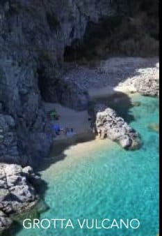
8. San Gregorio Cave — Panajia of Caminia
From the beach by the San Gregorio cave to the Byzantine ruins of Panajia of Caminia, with shade, water, and a quiet pine-stop.
Next stage
10. Santa Maria Vetere — Monastery — Arches
Return inland via Castrum and the village, visiting the Capuchin Monastery and the historic center before closing the loop back at the arches.
Supporting this stage helps improve the public route experience.
Stage sponsor
An open space for families, citizens, businesses, and supporters who want to adopt a stage or a concrete need.
Support / sponsorSupport campaign
Suitable for sponsors focused on safety, shade, wayfinding, and viewpoints.
Support / sponsorMedia available for this stage.